Thing BIG
Strategic expertise in Cloud Technology, Node.js/TypeScript development, GIS, and AI-driven Cybersecurity to accelerate your business.

AWS Services
We can leverage AWS services to provide a fully managed and secure end-to-end cloud environment. This includes rapid infrastructure setup using tools like AWS CloudFormation, continuous integration and deployment (CI/CD) automation with AWS CodePipeline and CodeDeploy, robust security management via AWS IAM, and simplified DevOps workflows for code deployment to the cloud, ensuring high-velocity, reliable software delivery.
3 Reasons to Use AWS
Companies choose Amazon Web Services (AWS) primarily for superior scalability, cost-efficiency, and unparalleled security. The platform allows businesses to instantly scale resources up or down to meet fluctuating demand, utilizing a pay-as-you-go model that converts high fixed capital expenditure to variable operating costs. Furthermore, AWS offers the broadest set of security tools and compliance certifications globally, helping most companies meet stringent regulatory and data protection needs.
GIS Solutions
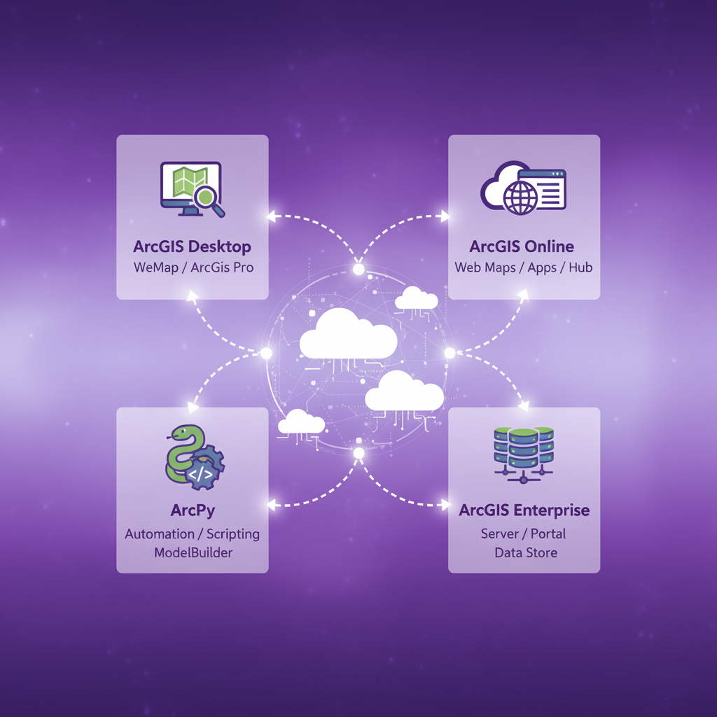
ArcGIS
Leverage our 15 years of certified ArcGIS experience to unlock the full potential of your geospatial data. Our expertise spans the entire Esri ecosystem, from foundational ArcGIS Desktop to modern web GIS solutions like ArcGIS Online and scalable ArcGIS Enterprise deployments. We build sophisticated, repeatable geoprocessing workflows using arcpy scripting combined with complex ModelBuilder tools, automating analysis to deliver precision and efficiency. Whether you need custom web mapping, enterprise system integration, or advanced spatial analytics, our certified team is equipped to solve your most challenging location-based problems.
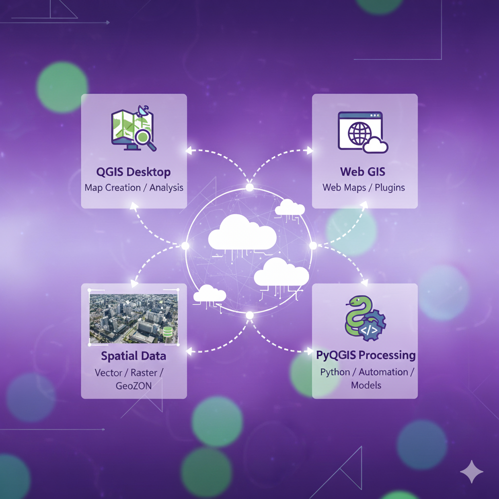
QGIS
Robust GIS solutions utilizing QGIS, the leading open-source platform, for flexible and cost-effective spatial analysis. Our expertise covers comprehensive desktop mapping and data visualization with QGIS Desktop, alongside developing custom web mapping applications and plugins for Web GIS integration. We excel in managing and processing diverse spatial data formats, including vector, raster, and GeoJSON, to extract meaningful insights. Leveraging PyQGIS for scripting and processing, we automate complex workflows and create custom models, empowering your projects with powerful, tailored geospatial capabilities without vendor lock-in.